We get up, get the kids breakfast and start to pack for the day. It takes over an hour after breakfast to get this crew going. Backpacks – check. Cameras – check. Maps – check. GPS – check. Sunscreen – check. Bug spray – check. Water bottles – check. OK – now everyone get boots on. What, you don’t like that kind of water? Look for another water bottle…. Stop at the restroom to fill with cold water. Back to the RV for change for the water vending machine….
When we get to the Visitor Center, the ranger informs us that we MUST watch the 6 minute video again and pay for the passes again. Sorry, policy and he has no way of knowing that the 5 listed on the pass from yesterday are the same as the group asking for a new one today. We learn again about the micro-biotic soil and not stepping on the plants, pay our $18 and head back to the Jeep.
Wendy wants to check once more into a possible white water rafting trip for Friday, so I start making some calls. Turns out the places I stopped earlier in the week were not completely correct. Yes, the normal trips that the outfitters run have turned into float trips due to the Colorado being high, but there are a couple who are doing a day trip down Cataract Canyon. This is listed as some of the biggest white water in the US – bigger than the stuff they run down the Grand Canyon. The trip consists of 6 hours of class 4 and 5 rapids and then a plane ride back to Moab for about $500 per person. They also all talk about the age and weight of the kids. One outfitter is not sure if they CAN take anyone under 18, will have to check and call back. The other does do it – they have newer boats that can handle the water, but we HAVE to make sure we are comfortable putting our kids in the boats. People do fall out, and it can take a long time to retrieve them. We decide to opt out on this trip.
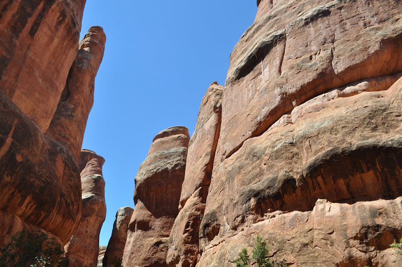
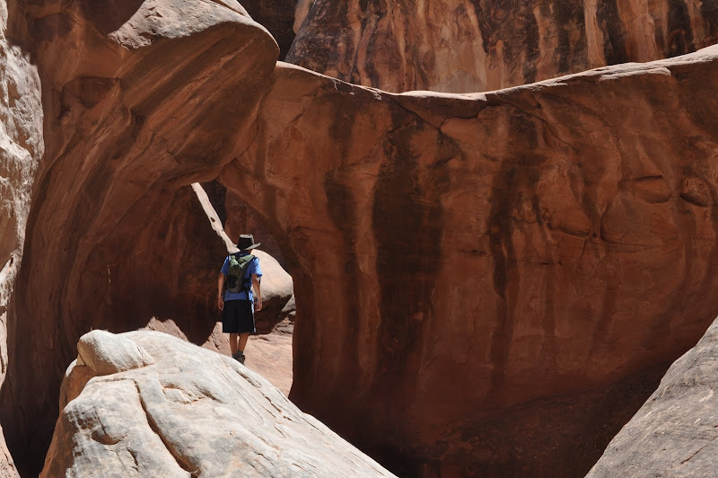
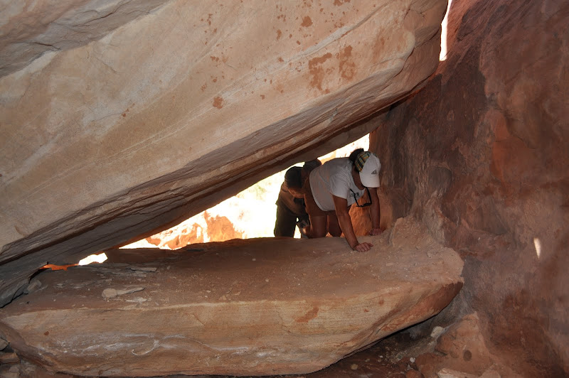
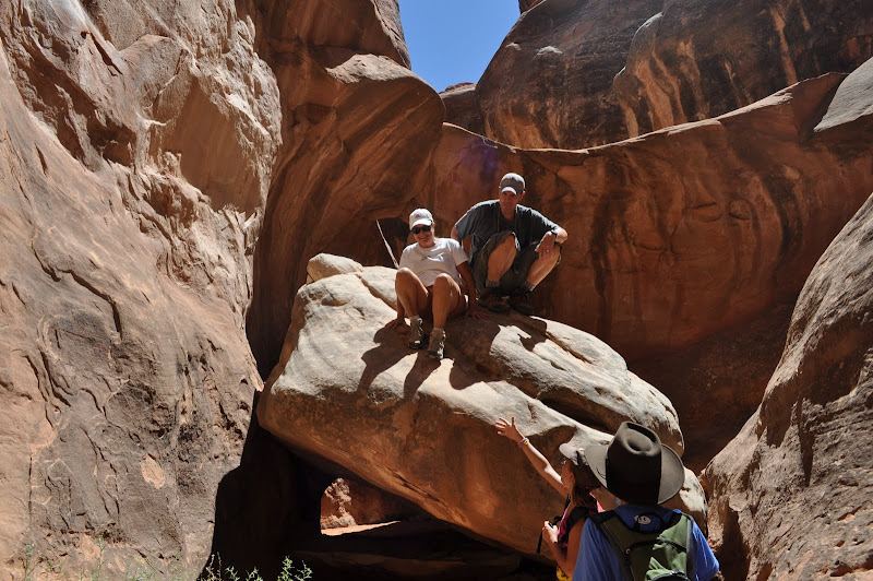
Off to the Furnace. This hike will take us down some rocks and into a bunch of fingers of caverns. Many of the fingers are dead ends; some go deep into the formations and branch off in many directions. Although I have my GPS, we will heed the advice of the ranger who first described it and keep an eye on the compass also. The GPS can lose its signal deep in the formations and will not leave you a track out. The first few fingers we head into are quick dead ends and, but then we hit one with some great walls and formations. The next one has us running into a group of scouts who have been in all morning canyoneering. They have ropes and I explain to Jackson that it is the only way to safely get into some of these areas. Some of the dead ends have a short climb down that will lead to new paths, but you have to make sure you can get back out. We hit a couple other fingers that have some arches and great spots to climb. Some require you to squeeze between or under rocks or climb over boulders to continue on. After over an hour of exploring, we decide to hike out.
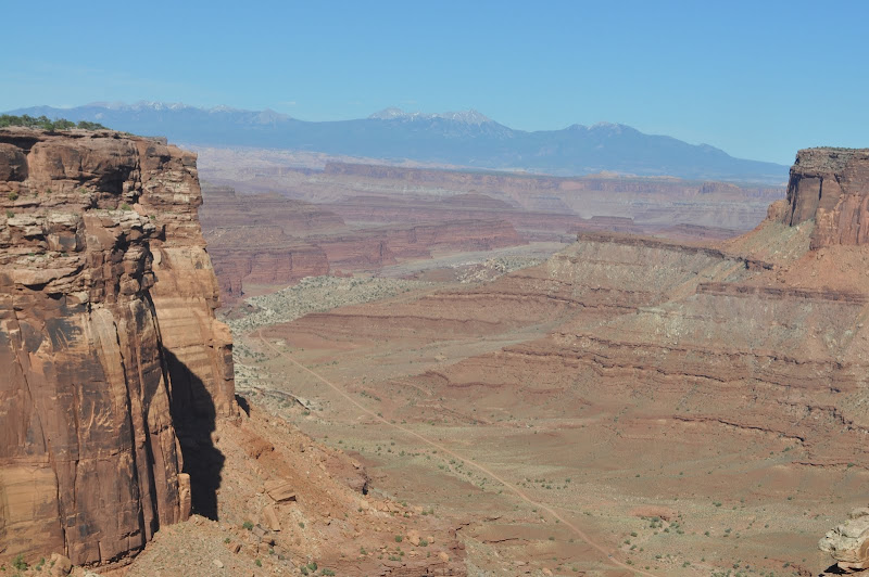
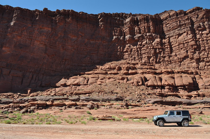
We drive back to the campsite for a quick lunch. The temp is now over 103 and we decide that more hiking is not in the plans for today. We opt instead for a Jeep ride on Shafer Trail. The people at the rental suggested this as a very scenic route and rated easy to moderate. 19 miles of twists and climbs ending in switch backs that take you from the canyon floor to the top of the ledges.
Turns out that somewhere along this route was where they filmed the famous Thelma and Louise scene where they drive the car into the canyon. Wish I would have known that as it would have been a great photo op.
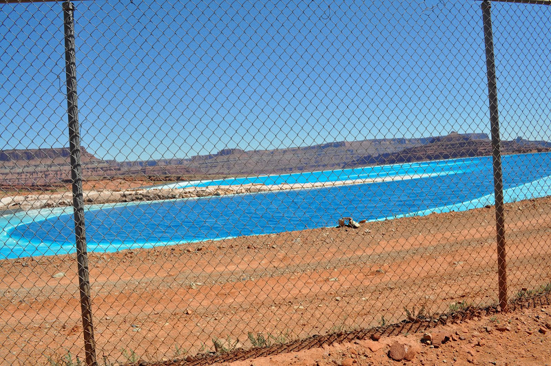
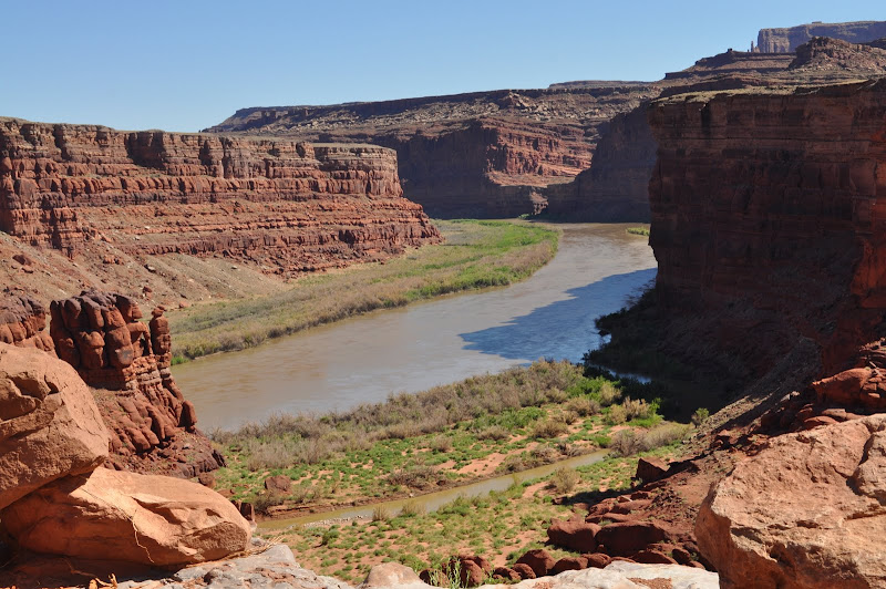
The trial starts along the Colorado and into the town of Potash. This is a big potash mining area. It continues along some twists and up rocks and ledges. Some fun stuff, but I only need to get it into 4 wheel low a couple times. We are looking up at Dead Horse Point and the formations from the bottom. We then continue on past some potash evaporation ponds. They extract the potash (which is used in fertilizer – a great source of potassium) by injecting water from the Colorado into the mine and pumping it miles to these holding ponds. In the hot arid climate (average humidity here is 20% in summer) the brine then evaporates leaving just the potash. They then scrape it out and haul it by train. The ponds are a very strange shade of dark blue and turquoise.
As we head toward the end of the trail, it looks like we are coming to a sheer wall rising thousands of feet in front of us. Wendy comments that we have come to a dead end. I tell her that all the cars coming the other way would tell me otherwise, and the map shows a couple switchbacks heading the wall.
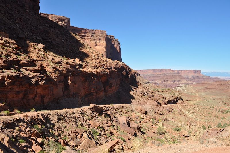
A COUPLE switchbacks – BS. Over 1600 feet of twists and climbs with a road that is barely wide enough for the Jeep. Georgia is NOT pleased. And we keep coming up on other vehicles coming the other way. My fear is that we will hit a spot where we need to back up to a place wide enough for both cars to get though. There are some crazy people out here. We have a 4-wheel drive Jeep with high clearance. We come across a German couple in a rented Buick LeCrosse. He is sure they will make the 18 mile trek with no problems. I wish him luck and continue on.
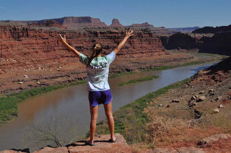
Finally at the top, we all breathe a sigh of relief and head (on paved roads) to Dead Horse Point. This is a state park with some magnificent views of the valley below. Cowboys used to round up horses in this area. They would drive them to the point as it is a large area with a very narrow (33 yards across) area that they could fence off to keep the horses in. The legend is that they left a large number of horses on the point with no food or water. Hence, Dead Horse Point.
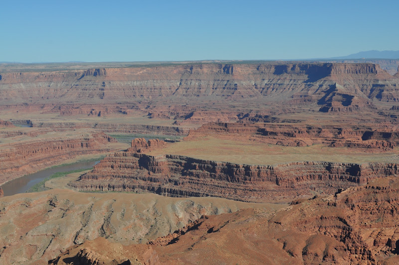
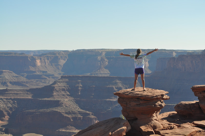
We drive out to the end, take in the sights and take some great pictures. We opt to grab some dinner in Moab rather than try to beat the clock getting back to the RV and the generator ban at 8:00. Jackson fires up Yelp and we check out the menu at the Moab Brewery. Sure sounds good to me, and they seem to have a good selection for the kids. The inside is fun with a rafts, hang gliders and kayaks on the walls. They put us next to a jeep with a looping video of some Jeeps doing very technical runs up rocks boulders. I point out that the Jeep we are in CAN do that stuff, so I really have not pushed it TOO far. Dinner is good, the beer is cold. I try the steak sirloin tips with their homemade BBQ sauce. FAB! Even the salad with a chipotle vineagerette is a nice surprise.
We then pick up some milk and ice and head the 18 mile back to the campground. We are all very hot and tired. As I drive back, the low fuel light comes on. I figure I have 50 miles to empty, but half way back, the needle drops to below E. We would like to swing by Delicate Arch, but as I make the turn I notice the needle is not moving at all. Do I really have 40 miles left in the tank – or will I even make it back to the campsite. I decide to not push it, and head straight back. I will deal with the fuel issue in the morning.
Once back at the campground we open the RV to find out that it has heated up like a tin can in the hot sun. We are past the generator time to cool things down. Very hot. I sit outside where it is a cool 95. We hope it will cool off, but the night is very long. I have no problems getting some sleep as I am whipped, but Wendy is up with the kids most of the night getting them water (what do you mean you went to bed without a glass of water) and calming them as they toss and turn. Between the heat and the beating they have all taken in the Jeep, they are all pretty riled up. We discuss moving the next day – maybe this remote wilderness was not such a good choice???
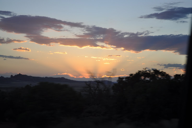
Ah, but look at the surroundings....